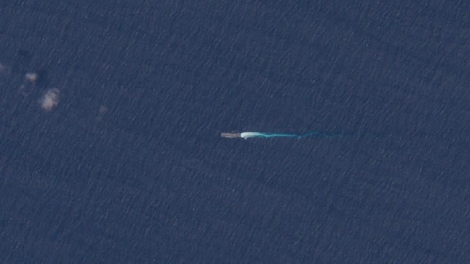
Satellite images taken by the European Union’s Copernicus Sentinel-2 mission show United States Navy ships moving towards Venezuela. Defense experts analyzed the photos taken on October 30 and concluded that one of the vessels was the amphibious warship USS Iwo Jima, reportedly sailing about 190 kilometers from Venezuela’s La Orchila Island. A second ship, believed to be the guided-missile destroyer USS Gravely, was maneuvering in the eastern Caribbean Sea, approximately 320 kilometers north of mainland Venezuela. On Friday (31), President Donald Trump denied considering authorizing attacks within Venezuela.
Satellite images show US ships heading towards Venezuela

-

Flamengo and PSG have faced each other three times; check out their record
-

Indonesia Open Footgolf Tournament: Comedian Oki Rengga Admits Addiction, Wants to Become a Professional Athlete
-

Shameful Incident in Punjab! Landlord Rolls Tenant’s Daughter
-

Virgil van Dijk Expresses Desire for Mohamed Salah to Stay at Liverpool
Deixe um comentário