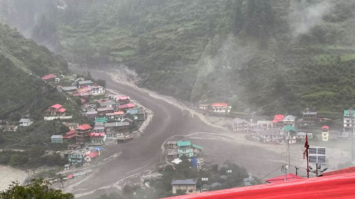
On Monday afternoon at around 2 PM in the Harshil area of Uttarkashi district, heavy destruction ensued near the village of Dharali due to clouds bursting. Suddenly, with a swift flow of water and debris, the village was engulfed, causing severe damage to several houses. Upon receiving the information, rescue teams were deployed to assist the affected individuals. The sudden flood due to the cloud burst left a trail of destruction, affecting the daily lives of the residents in the region.
The catastrophe unfolded near the Gangotri Dham, a major pilgrimage site, as the debris from the burst cloud filled the Ganga river, leading to widespread devastation. Reports stated that around 2:30 PM, the flood unexpectedly surged, spreading debris in all directions, causing considerable chaos and destruction in its wake. The authorities were swift to respond, providing necessary aid and support to the affected residents.
As rescue operations were underway, efforts were made to evaluate the situation accurately. The Indian Space Research Organisation (ISRO) was approached to request satellite images of the region to determine the precise cause of the disaster. The images would be instrumental in understanding the extent of the damage caused by the cloudburst and formulating strategies for future disaster management.
The calamity in Harshil brought to light the vulnerability of the region to natural disasters like cloudbursts, necessitating a comprehensive approach to mitigate risks and enhance preparedness. The involvement of ISRO in providing satellite imagery highlights the importance of leveraging technology for disaster response and recovery. The continuous monitoring and analysis of such incidents are crucial for developing effective disaster management protocols to safeguard lives and infrastructure in vulnerable areas.


Deixe um comentário